
Reviewed · HIKING & TREKKING
Almaty: Advanced Hiking – Four Peaks Hike
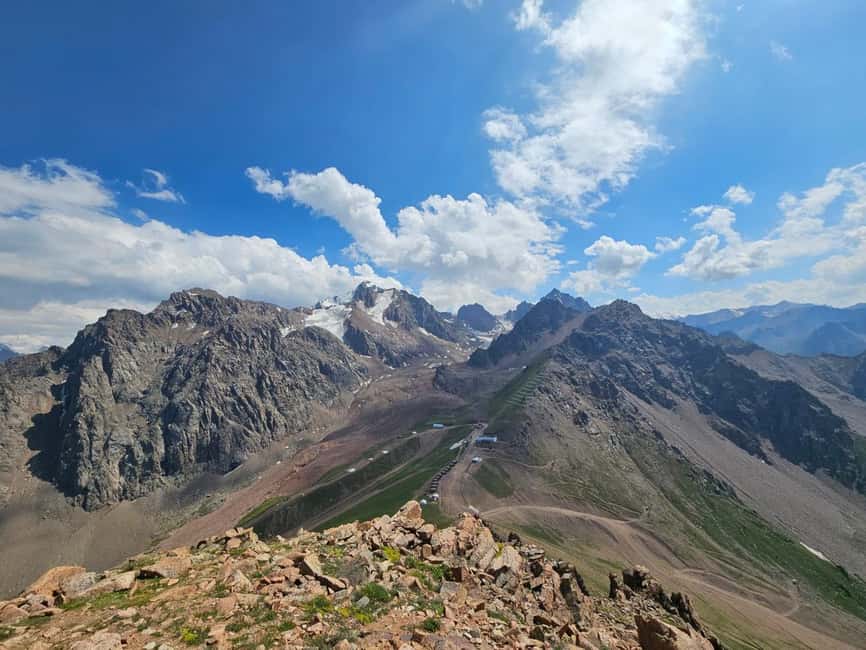
Almaty’s Four Peaks hike is a serious mountain day, not a gentle outing with a view at the end. You climb as much as 2,000 meters, cross high ridges, reach Chimbulachka at 3,450 meters, and finish at the upper Shymbulak cable car station.
I like the private format, since your guide can control the pace and keep a close eye on safety. I also like the route’s variety: mountain swings, four named summits, wide views over Almaty, and a cable car descent instead of one last punishing walk downhill.
The catch is simple: this is an advanced hike. Ten hours on rough mountain ground, with steep climbing and possible snow or ice, will test your legs. If your fitness is only moderate, choose an easier Almaty mountain walk instead.
Four peaks and one long mountain day
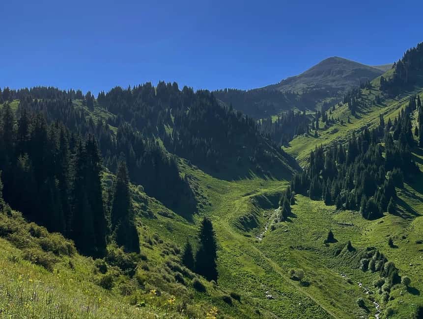
- Furmanov Peak at 3,050 meters gives you the first major summit and a strong sense of the scale of the Ile Alatau.
- Panorama Peak at 3,200 meters is the route’s great viewpoint over Almaty and the higher mountains.
- Bashuta Peak at 3,400 meters pushes the climb into serious high-altitude territory.
- Chimbulachka Peak at 3,450 meters is the highest point and the main prize for experienced hikers.
- Private guiding with poles, GPS, transfers, and winter crampons keeps the logistics simple and the focus on the trail.
- Kazakh chocolate along the way is a small local touch that matters on a long, tiring day.
Why this hike is different from an Almaty day trip
Many mountain outings near Almaty let you reach one viewpoint, take a few photos, and return to town. This route asks more of you. It links four peaks into one continuous ridge journey, so the reward comes from sustained effort rather than a single short climb.
You begin at about 1,845 meters in the Kim Asar Valley. The highest point is 3,450 meters, a gain of roughly 2,000 meters over the course of the day. The published distance is given as approximately 11.5 kilometers, while the wider route description places it at about 15 kilometers. That difference likely reflects route changes and seasonal conditions, but you should prepare for a full mountain day rather than plan around the shorter figure.
The payoff is constant high-country scenery. You get changing views as you climb, then wider sightlines along the ridge. From Panorama Peak, the route is especially well named: you can look toward Almaty and the surrounding Tien Shan ranges with fewer visual interruptions than on a lower forest trail.
The route is also private. You are not tied to the speed of a large group, and the guide can adjust the pace to your ability. That does not make the hike easy, but it can make a hard day more manageable and safer.
A few more Almaty trips to weigh up
- Big Almaty Lake Tour with Optional Hike
★ 4.3 · 109 reviews - Big Almaty Lake tour private or group by car or hiking
★ 4.5 · 46 reviews - Big Almaty Lake tour by hiking
★ 5.0 · 34 reviews
From Kim Asar Valley to the mountain swings
Hotel pickup starts the day in Almaty, with the transfer taking you toward the trail area. The starting altitude is 1,845 meters, so you begin below the main summits and gain height steadily rather than stepping straight into thin mountain air.
The first walking sections take about an hour each, according to the planned timing. This gradual opening gives you time to settle into your pace, check your footwear, and use the trekking poles properly. Your guide is there to manage the route and watch how you are handling the climb.
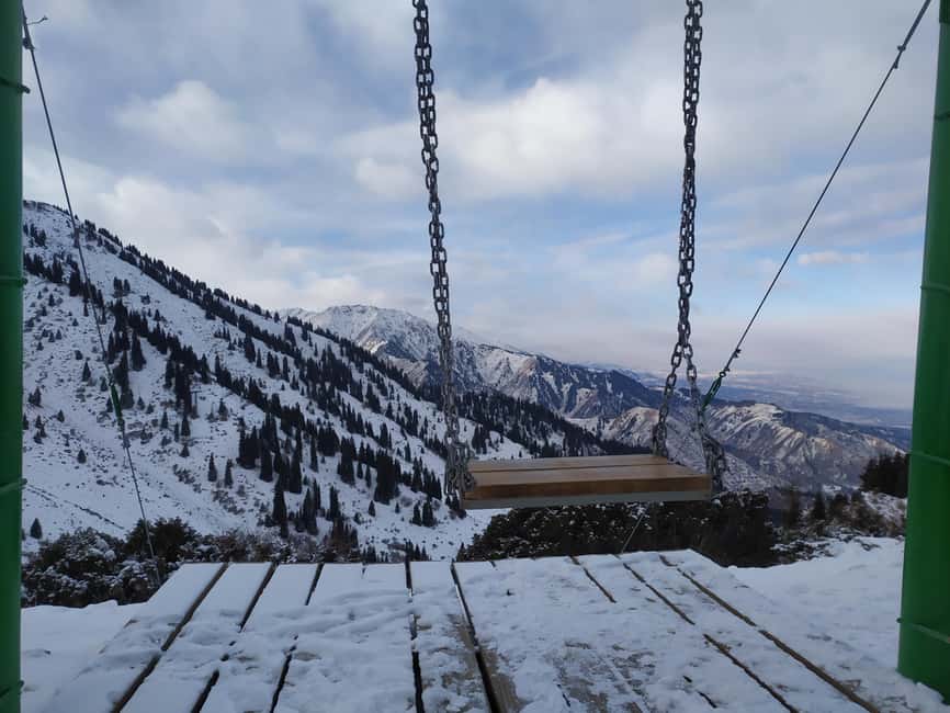
The mountain swings are an early highlight. They are a memorable stop and a popular photo point, but they are not the reason to book this experience. Think of them as a pleasant break before the real work begins. After this point, the route becomes increasingly demanding.
You should not expect a smooth park path. The experience is built around rugged alpine ground, long climbs, and confidence on mountain terrain. Wear proper hiking shoes, not casual trainers. Bring warm layers even if Almaty feels mild at street level, since conditions can change quickly with altitude.
Furmanov Peak at 3,050 meters
Furmanov is the first named summit on the route and arrives after a substantial climb. The planned section from the earlier stops to Furmanov takes about an hour and a half, though the guide may alter the rhythm depending on weather, ground conditions, and the group’s pace.
At 3,050 meters, Furmanov is high enough to make this feel like a real alpine outing. Reaching it gives you an early measure of the day ahead. You still have Panorama, Bashuta, and Chimbulachka to come, so this is not the time to spend every bit of energy celebrating.
I like this structure because the route gives you clear milestones. You are not simply walking toward an unnamed high point. Each summit provides a practical target, and each one helps you judge how much stamina you have left.
The downside is that the first peak can create false confidence. You may feel strong at Furmanov, then discover that the ridge crossing requires more effort than expected. Keep eating and drinking before you feel exhausted. Kazakh chocolate is supplied as a small energy boost, but it is not a substitute for bringing your own food.
The ridge to Panorama and Bashuta
After Furmanov, the trail follows a ridge toward Panorama Peak. The planned walking sections include several stretches of about an hour, followed by a longer section of roughly two and a half hours. This is where the route’s endurance requirement becomes clear.
Panorama reaches 3,200 meters and offers broad views toward Almaty and the higher Tien Shan. The name tells you what to expect, but the important point is that this is not only a photo stop. It marks a higher stage of the route, and the ridge walking around it demands steady footwork.
Bashuta rises to 3,400 meters. By now, you have climbed a long way and crossed several sections of exposed or uneven mountain ground. The route’s attraction is also its challenge: you keep moving through a succession of high points instead of returning to lower ground after each summit.
Your guide’s role matters most here. The private format allows the guide to keep the group together, set breaks, and assess whether conditions remain suitable. The guiding team carries a GPS navigator because mobile coverage is not available on every route. That is a useful safety measure, especially in high terrain where a phone should not be your only navigation tool.
The experience has received its strongest praise for guide care and organization. Victor was specifically noted for making safety a priority, while Valihan was praised for leading the tough route in an organized way. Temirlan was also named as a friendly and capable guide. Ask ahead of time who is scheduled to lead your hike, since the experience is provided by the Temirlan_guides team.
Same mountains, a completely different day out:
- Almaty: Charyn Canyon, Kolsay, and Kaindy Lakes Day Trip
★ 4.7 · 1,522 reviews - Kolsai, Kaindy Lakes and Charyn Canyon Small-Group Tour
★ 5.0 · 642 reviews - Almaty: Kolsai-Kaindy Lakes and Charyn Canyons Day Trip
★ 4.7 · 505 reviews - From Almaty: Kolsay, Kaindy Lakes and Charyn Canyon Day Trip
★ 4.6 · 452 reviews
Chimbulachka at 3,450 meters
Chimbulachka is the highest summit of the standard warm-season route, at 3,450 meters. It is the point where the day’s climbing reaches its maximum, and it will likely feel significant even if you regularly hike at home.
The final approach requires stamina more than speed. A guide can help you keep a sustainable rhythm, but you still need to do the climbing yourself. The route description calls for good physical fitness, endurance, and confidence on mountain terrain. Take those words seriously.
At this height, sun protection is essential. Bring sunscreen, a cap, and sunglasses, even in cooler weather. Also pack extra warm clothing. Mountain temperatures and wind can be very different from conditions in Almaty, and the tour runs year-round with route changes for the season.
A high summit is not a guarantee of clear views. Weather can affect what you see, and the route may be adjusted for safety. That is one reason a private guided hike is more sensible here than trying to follow a demanding ridge route alone.
A cable car finish at Shymbulak
After the ridge traverse, the standard route reaches the upper Shymbulak cable car station at about 3,200 meters. You then descend by cable car to the valley, followed by the return transfer to Almaty.
This is one of the smartest parts of the design. After up to 2,000 meters of climbing and a long ridge crossing, walking all the way down would add extra strain to tired knees. The cable car gives you a comfortable finish and a final scenic look at the mountains.
The planned transfer back to Almaty takes about an hour and a half. With the walking sections, stops, transport, and cable car logistics, you should reserve around ten hours for the complete experience. Pickup and drop-off at a location of your choice are included, so you do not need to arrange a separate taxi to the trailhead.
The cable car is also the main logistical point to check before booking. Maintenance periods from April to May and September to November can affect the route. If the cable car is unavailable, the guide may need to adjust the plan.
Winter changes the whole challenge
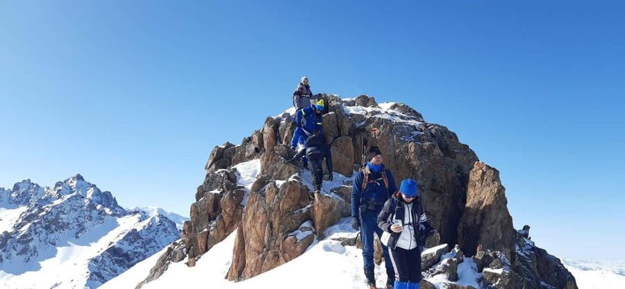
In winter, the route runs in reverse. You ascend by cable car to 3,200 meters, climb toward Chimbulachka, and then descend on foot toward Kim Asar Valley.
That reversal matters. Winter snow and ice make the high sections harder, and the long descent can be tiring even though you are no longer climbing. Snow crampons are provided and fit over winter boots, while trekking poles are supplied for every participant.
April and November can bring avalanche risk, so seasonal conditions deserve careful attention. The route may be changed or restricted when safety requires it. Your guide contacts you a few days before the hike to confirm the weather and equipment recommendations, so keep WhatsApp or Telegram active on a valid mobile number.
Winter can offer a striking mountain setting, but it is not the best choice for an inexperienced walker. You need warm clothing, suitable boots, and comfort on slippery ground. If you dislike cold conditions or have limited fitness, book in a more stable season or select a shorter walk.
What is included and what you need to pack
The $210 price includes private hotel transfers, national park entry when required by the route, an English-speaking guide, trekking poles, and Kazakh chocolate. Winter participants also receive snow crampons. The guide carries a GPS navigator, which is useful where phone coverage is limited.
Lunch and dinner are not included. Bring enough food and water for a long day, since no meal is provided in the tour price. The supplied chocolate is a welcome extra, but it should be treated as a snack rather than a full lunch.
Pack:
- Hiking shoes with secure grip
- Comfortable hiking clothes
- Warm and spare clothing
- Sunscreen
- A cap
- Sunglasses
- Your own lunch and drinks
- A phone with WhatsApp or Telegram for tour communication
Travel insurance is optional for tourists at an additional fee. The activity is not suitable for children under 16, pregnant women, people with heart problems, people over 80, or people with high or low blood pressure. A moderate level of fitness is the stated minimum, but the actual route is best suited to someone with strong stamina and previous mountain experience.
Is $210 a fair price?
For a casual sightseeing outing, $210 is a lot. For a private ten-hour mountain day with transport, guiding, safety equipment, park access, and a cable car finish, the price is easier to justify.
The key value is the private guide. You are paying for route control, pacing, local mountain support, and help dealing with changing conditions. Transfers also save you the trouble of arranging early transport to the valley and a return journey after a tiring day.
The price is less attractive if you already have strong route knowledge, your own transport, navigation equipment, and a hiking partner who is comfortable with high alpine ground. But most visitors do not have that combination, and this route is not a sensible place to rely only on a phone map.
Free cancellation up to 24 hours before the activity and the option to reserve now and pay later make planning easier. Still, check the cable car situation and seasonal conditions before you commit to a particular date.
Who should book the Four Peaks hike?
I would choose this hike if you want a hard physical challenge close to Almaty and consider the mountain effort part of the holiday. It suits experienced hikers who can walk for eight to ten hours, handle steep climbs, and stay comfortable on rough or snowy terrain.
It is also a good fit if you prefer private guiding over a large group. English is available, and the guide can set a pace suited to your abilities. The safety focus has been a repeated strength, with Victor, Valihan, and Temirlan all specifically praised for careful, capable guiding.
I would not choose it for a first-ever mountain walk, a relaxed family day, or a trip where you need a predictable low-effort schedule. The elevation gain is substantial, and bad weather can change the plan. You should also avoid booking it if you have any of the listed medical restrictions.
Should you book it?
Book the Four Peaks hike if you want Almaty’s mountains at their most demanding and rewarding, and if four summits matter more to you than an easy day out. The route offers excellent value for a private experience, particularly because transfers, equipment, park entry, and safety support are included.
Skip it if you are unsure about your fitness, dislike snow and steep ground, or want plenty of spare time for other Almaty activities. For the right hiker, though, this is a memorable way to see the Ile Alatau, with Furmanov, Panorama, Bashuta, and Chimbulachka linked into one tough day.
FAQ
How long does the Four Peaks hike take?
The full experience lasts about 10 hours. The hiking itself is listed at 8 to 10 hours, with the exact timing affected by pace, weather, route conditions, and seasonal changes.
How far is the route?
The route details give a distance of 11.5 kilometers, while the wider description says approximately 15 kilometers. You should prepare for a long mountain route, since the total distance can vary with conditions and route adjustments.
How much elevation do I gain?
The hike begins at about 1,845 meters and reaches a high point of 3,450 meters at Chimbulachka. The total elevation gain can reach 2,000 meters.
Which peaks do I visit?
The route visits Furmanov Peak at 3,050 meters, Panorama Peak at 3,200 meters, Bashuta Peak at 3,400 meters, and Chimbulachka Peak at 3,450 meters.
Is the hike available in winter?
Yes, the experience operates year-round with seasonal restrictions. In winter, you generally ascend by cable car to 3,200 meters, hike to Chimbulachka, and descend on foot toward Kim Asar Valley. Snow crampons are provided.
What equipment is included?
Trekking poles are provided for every participant. On winter hikes, snow crampons are included. The guide also carries a GPS navigator because mobile signal is not available on every route.
Is lunch included?
No. Lunch and dinner are not included, so you need to bring your own food and drinks. Kazakh chocolate is provided as a small snack during the hike.
Just added around Almaty
- 2 Days Private Kolsai and Kaindy Tour★ 5.0 · 4 reviews
- Private Big Almaty Lake Hiking Tour with alternatgive Pipeline★ 5.0 · 4 reviews
- Personalized guided Car Tours to Charyn Canyon & Kolsay Lake★ 5.0 · 4 reviews
- 2 day tour to Altyn Emel Singing Dune and Aktau mountain★ 4.5 · 4 reviews
- Private Day Tour to the Land of Canyons-UNESCO-of Kazakhstan★ 5.0 · 4 reviews
- Altyn Emel, Singing Dune, Charyn canyon, Kolsay, Kaindy lake 4 days tour★ 5.0 · 3 reviews
- Charyn canyon, Kolsai lake, Kaindy lake 2 Days★ 5.0 · 4 reviews
- City Pub Crawl Almaty★ 5.0 · 3 reviews
Hiking & Trekking, compared.
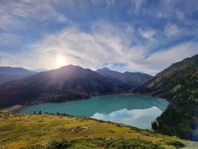
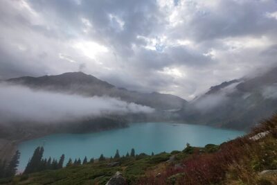
Big Almaty Lake tour private or group by car or hiking
Read our review →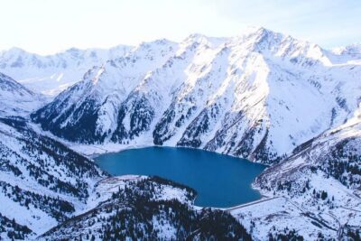
3-Day Private Horseback Riding and Hiking Tour in Kolsay
Read our review →
Shymbulak to Bogbanovisch Glacier and Oktabriskaya Hike
Read our review →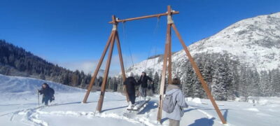
Browse the lists this tour appears in